Understanding types of reference maps
Maps of all kinds have been used for centuries to help people understand the world better. While some are designed for navigational purposes, others are meant to indicate geographical boundaries, names, and the structural outline of areas. Further, professionals use specialized ones for weather predictions or to analyze rainfall distribution or other patterns. Nevertheless, all maps can be broadly categorized into two kinds—reference and thematic. Here, different types of reference maps are explored.
Understanding general reference maps
These are the maps taught in schools. Reference maps indicate the location of cities and towns and also show major transport routes like highways.
Types of reference maps
Political: These are the most common introductory maps, especially in schools. They show the geographic boundaries of countries and states and water bodies like oceans, lakes, rivers, and seas. Examples could be a world map or the map of Europe. You can also find the map of a particular region online.
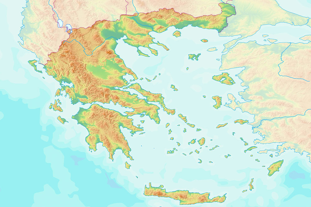
Physical: This type documents the features of the landscape. They are used to show the topography based using a color code. For instance, water bodies are shown in blue, areas near the sea or at sea level in dark green, and glaciers are represented in white. You can distinguish different kinds of surfaces based on the color assigned to them,
Road, street, and highway: As the name suggests, this type shows roads, streets, highways, and other defined areas around them. The most popular mapping system is Google maps which covers all kinds of roads and tiny localities. It is the best way to get directions and to travel/commute from one place to another. This type of map is a useful tool, especially if you are new to an area or are planning to travel to an unknown region. A detailed map like this can help you find essential places like markets or subway stations.
Topographic: Similar to physical maps, this type indicates the shape or topography of the earth. However, topographic ones use contour lines instead of colors to show different physical features. However, at times colors can be used to indicate elevation. They are most often used by people who enjoy outdoor activities or sports like hikers and skiers. Further, surveyors, geologists, and military personnel also use these tools.
Time zone: This type is used to determine the time in a particular part of the world. There are 24 time zones, and time zone maps indicate all of them using different colors. The maps have numbers at the top and bottom, using which people can determine the difference in time between two locations. This type can be quite useful for international businesses.
Geologic: This type shows the types of rocks and sediments below the surface in a geographic area. This map type also uses colors as references. For example, shades of yellow are used to indicate sediment, whereas rock units are shown in various shades depending on their mineral composition or lithology. These are tools used in construction projects to check the availability of materials. Created by geologists, the maps could come with a cross-section of the area, showing you what the land would like if you sliced through it.
Zip Code: This type shows the boundaries of an area based on its zip code. They are mostly used by the postal service to help navigate the mail delivery routes. The map is plotted over a base map of roads and streets. When combined with data from the census, these maps can help businesses target customers or potential customers in a zip code based on other factors like age, income, and housing.
With advances in technology, it is easy to find any kind of map you want by conducting a simple search online. You can also find them in an atlas, which is a book of maps, or in your local library.
Reference maps are invaluable tools that help people understand the area around them better. Depending on the type, you can learn about the world topography, different time zones, and even points of interest (like airports, stores, and more) in your area. Most people use one or more types of reference maps on their GPS and navigation systems without even realizing it.

